
If you’re planning to sell a rural property—be it a farmhouse, a few acres of land, or a country home with a long gravel driveway—you’ve probably already been told that first impressions count. But what if I told you that the very first impression many potential buyers get isn’t from a visit or even a phone call—it’s from a photo taken from 100 feet in the air?
Welcome to the world of drone photography. And if you’re selling a countryside property in Essex, Suffolk, or Norfolk, aerial imagery could be the smartest move you make in your marketing plan.
Why Drone Photography Has Become a Must-Have in Rural Property Marketing
Selling More Than a Home – You’re Selling the Whole Picture
In my early years photographing properties in the countryside, I’d often stand in a muddy field, camera in hand, trying to capture the “feel” of the place—rolling paddocks, a distant copse, or a stream running along the boundary. Ground-level shots just didn’t do it justice.
Now, with a drone, I can show everything in one frame: the home, the land, the setting, and the lifestyle.
If your property sits on more than half an acre, has outbuildings, or is beautifully secluded, aerial photography shows that instantly. You’re not just selling four walls—you’re selling peace, potential, privacy. And that’s what drone images convey with clarity.
Making Your Listing Stand Out Online
Most buyers begin their search on Rightmove, Zoopla, or estate agents’ websites. Think of drone photography as your chance to make them stop scrolling. A stunning bird’s-eye view can act like a magnet in a sea of ordinary front shots.
I had one client near Sudbury who’d been on the market for six months with standard photos. We did a quick drone session, replaced the lead image—and they had three viewings in the first week after relisting. Sometimes, it’s not about the price, it’s about the presentation.
Why Rural Essex and Suffolk Sellers Are Turning to Aerial Imagery
A Hot Market for Land and Lifestyle
From equestrian buyers to families moving out of London post-pandemic, the demand for countryside homes with land has surged. But these buyers are often comparing properties across counties—and drone shots help yours stand out in that regional search.
In rural Essex (think areas like Dedham Vale, the Dengie Peninsula or around Saffron Walden), buyers want to know: how private is it? Where are the fields? What does the access road look like? A drone answers all these questions instantly.
Suffolk sellers—from Bury St Edmunds to Woodbridge—are seeing similar interest, especially for homes with an annexe or potential to develop. Aerial photos help show what’s possible.
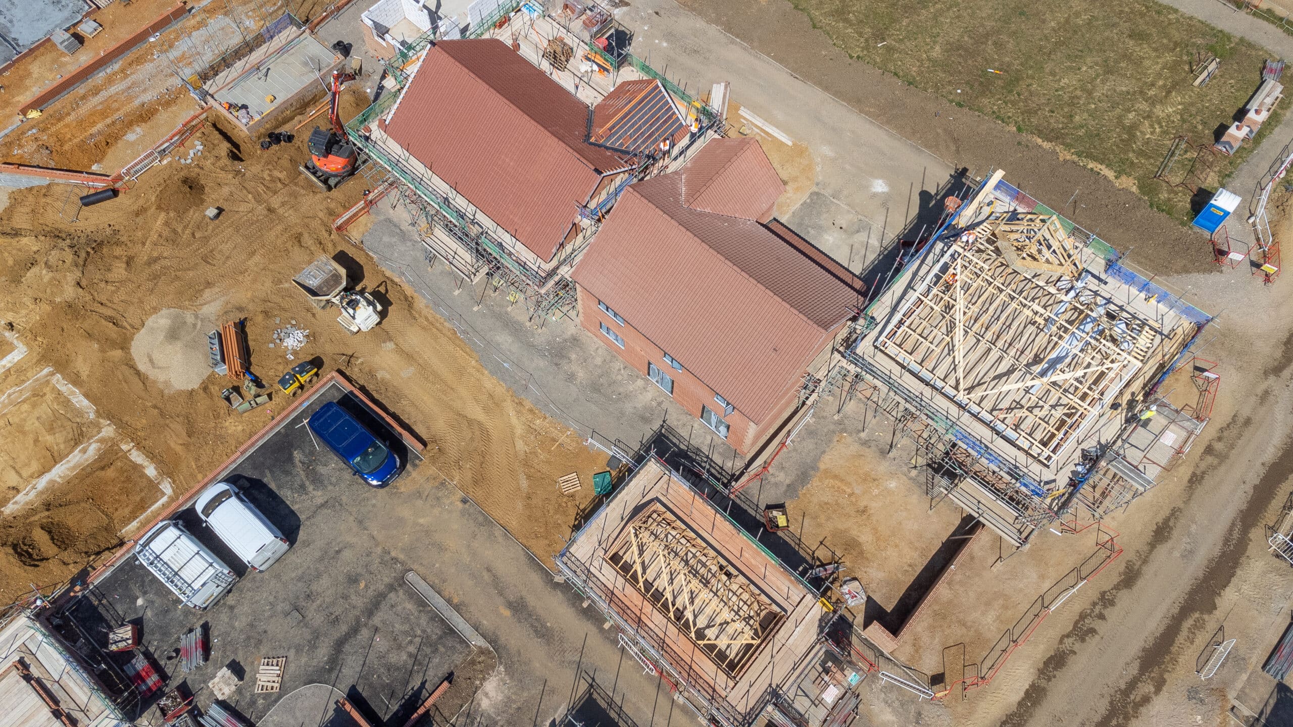
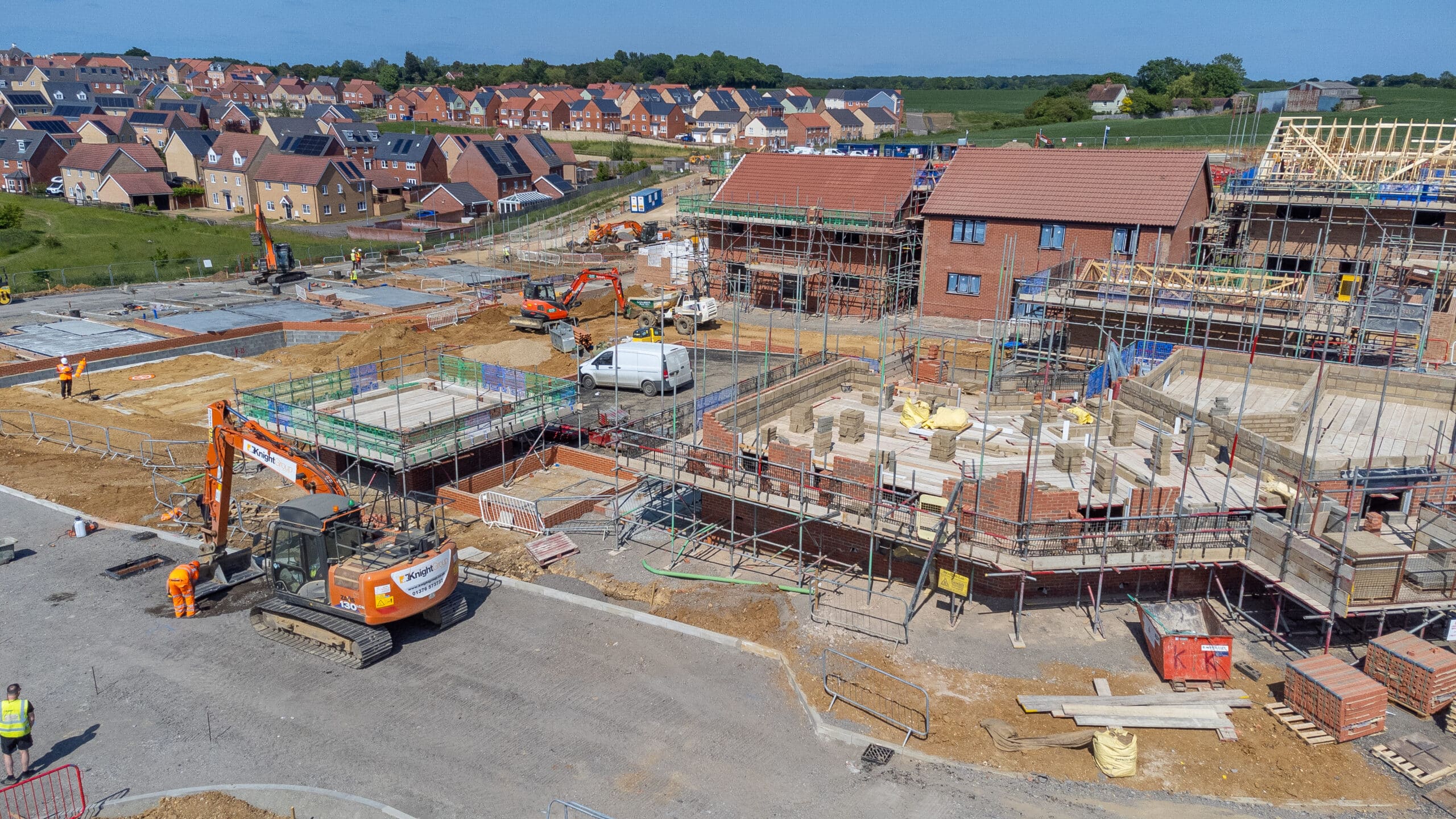
What Drone Photography Reveals That Ground Photography Can’t
Here’s just a taste of what a drone photo (or video) can reveal in seconds:
The full extent of your land or garden
Driveways, parking, and access routes
Orientation of the property in relation to the sun (especially for garden-lovers)
Proximity to open countryside or woodlands
Privacy from neighbours or roads
Outbuildings, stables, greenhouses, or orchards
Boundaries and layout—perfect for buyers planning future development
One of my favourite shoots last year was a farmhouse near Halesworth. On the ground, you could see the charming garden and a bit of the paddock. From the air? We saw the line of mature oak trees bordering the plot, the post-and-rail fencing, and a meandering stream beyond the back hedge. It was like revealing the real property story.
How Drone Photography Works – The Process Made Simple
Step 1: A Friendly Chat
Before any drone goes up in the sky, I’ll ask a few questions:
What are the key selling points of your property?
Where do the boundaries run?
Are there any angles you’re particularly keen to showcase?
This helps plan the flight path and choose the best light for the shoot.
Step 2: Flight Planning and Permissions
I’m a CAA-licensed drone pilot with full insurance, so all flights are carried out legally and safely. I always check local airspace restrictions and do risk assessments. If your property is near an airfield or in a flight-restricted area, I’ll sort the paperwork.
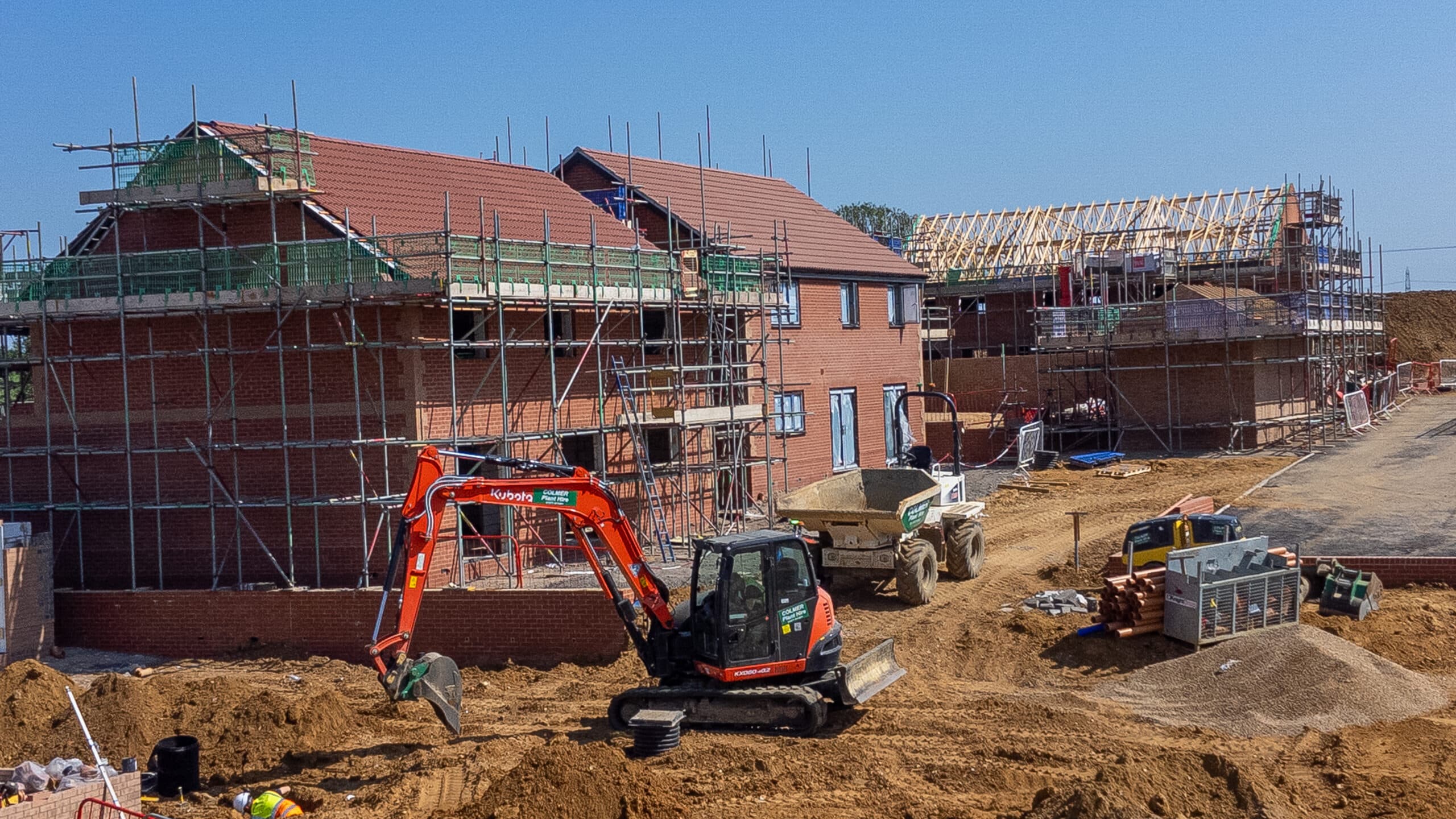
Step 3: On-Site Shoot
On the day, I’ll typically be with you for 45–90 minutes. I’ll take both high-altitude overview shots and lower ‘sweeping’ images that show off buildings, features and textures. If you want a cinematic-style video fly-through, that can be arranged too.
Step 4: Image Editing and Delivery
Within a couple of days, you’ll receive a gallery of high-resolution, professionally edited images—ready for your estate agent, brochure, or online listing.
Cost vs. Value – Is It Worth It?
Drone photography packages usually start from around £95–£150, depending on location and size of the property. Compared to your potential sale price—especially for homes valued over £400,000—it’s a small but powerful investment.
If you’re selling land or development plots, drone images can make the case for planning potential far better than a written description. And for larger properties, buyers expect a drone shot these days—it gives them confidence that the agent (and seller) is presenting the home transparently and professionally.
What to Look for in a Rural Drone Photographer
Not all drone operators are created equal. Here’s what I’d suggest checking:
Local knowledge – Someone familiar with the terrain, light, and rural charm of East Anglia
Experience with rural and land-based properties – Farms, equestrian homes, and plots require a specific approach
CAA certification and insurance – It’s the legal minimum, and protects everyone involved
Ability to advise – Sometimes I suggest including part of the surrounding countryside in a shot for context; other times, tight framing is best. You want someone who sees with both a photographer’s and buyer’s eye.
Is Drone Photography Right for You?
If your property has any of the following:
More than a third of an acre
A long driveway or multiple outbuildings
Exceptional views or natural surroundings
Land for equestrian, farming or development
A secluded or private feel
…then yes, drone photography will almost certainly help you sell smarter—and possibly faster.
Final Thoughts (and a Friendly Nudge)
You only get one chance to make a first impression—and in rural Essex and Suffolk, where properties are unique and land is valuable, that first impression should be as complete as possible.
I’ve worked with dozens of local homeowners, farmers, and even estate agents across the region, helping them show off their property from its best angle—above.
So whether you’re selling a country retreat near Colchester, a horse property near Newmarket, or a barn conversion in Thetford Forest, drone imagery is the modern way to tell your story.
Ready to See Your Property From Above?
If you’re preparing to sell and want to explore how aerial photography can help, I’d love to chat. I work across Essex, Suffolk and Norfolk, and always offer a no-pressure consultation.
 Call me for a chat, or
 Drop me a message to see examples of recent countryside shoots.
Let’s get your property looking its best—from the ground and the sky.
If you’d like to chat with us… Call us at 01842 267567
If you prefer email send us a message here: Send mail!

Block House Food Photography Shoot
Food Photography Block House Food Photography Shoot Why Loyalty Still Matters in a Creative World

Distinguish Gentlemens Drive Out by Franks in Colchester
Commercial Photography Distinguish Gentlemens Drive Out by Franks in Colchester Cars, Charity, and Community Spirit

Content Creation 101: How to Get the Most From Your Shoot Day
Commercial Photography Content Creation 101: How to Get the Most From Your Shoot Day At

Not my Royal Mail
Professional Photography Not my Royal Mail Not My Royal Mail – A Personal Stand As